May 30, 2025

Minnesota Hiking Club #30 - Great River Bluffs State Park


Minnesota Hiking Club
#30 - Great River Bluffs State Park
Date Hiked: March 4th, 2025
Other Hikes That Day: None
Wanderloon Ranking System Score: 3.33

For once, it wasn't the cold or snow that led me to have a comparatively unique experience of a Hiking Club trail. 

There was only one park left in the entire southeast to do, mostly because of its W-coding and the others in proximity not being such. But I was excited to give this one the time and focus it deserved, because the river bluffs remind me so much of the Appalachian mountains where I grew up. I understand they are different geological landscapes and the latter is tremendously ancient, but they give me similar vibes. In a state that can be socially isolating to those who aren't from here, feeling some vague connection to even a concept of "home" is endearing. 

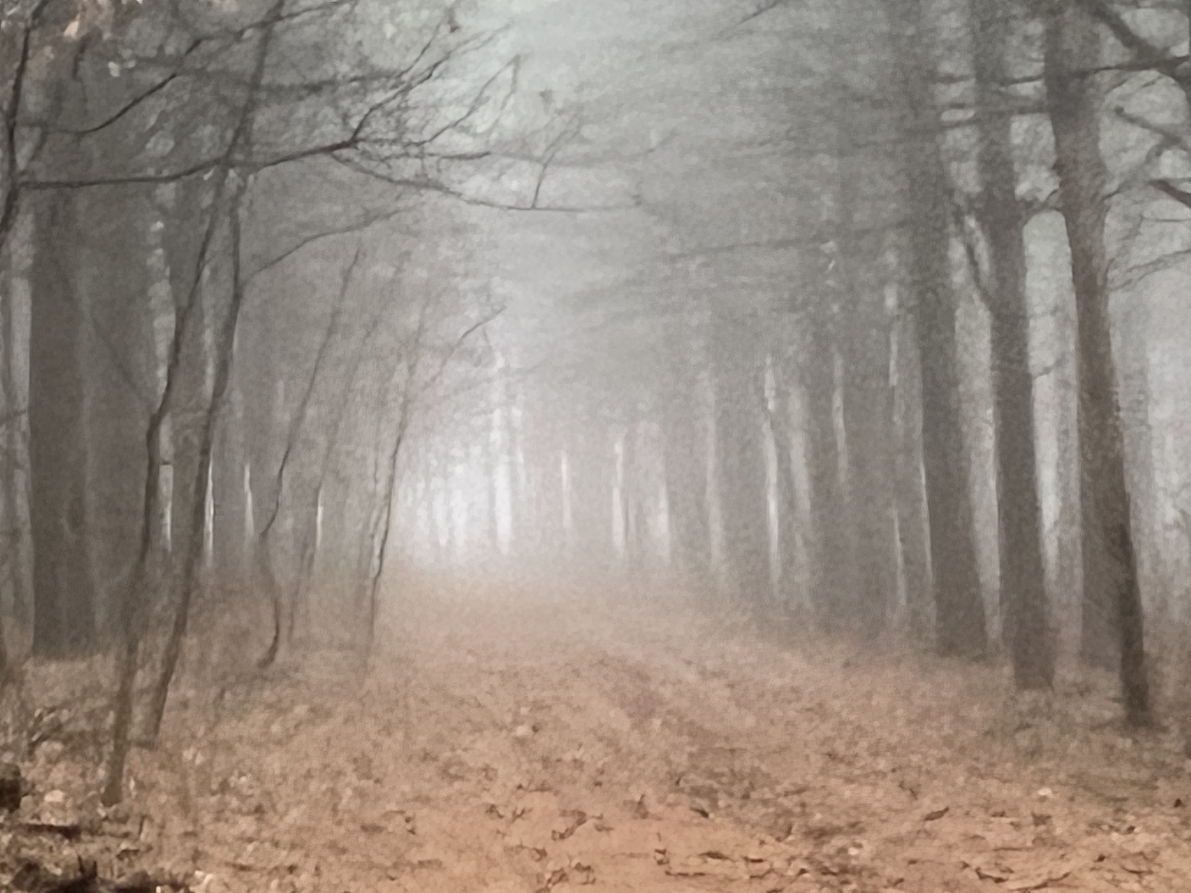
Sure wish I could've seen it though!

The Great River Bluffs State Park Hiking Club trail is shaped like a fancy signature with a heart in the middle. Where most are loops, this is a down-and-back with a small heart loop, and that is quite unique. Rather than climbing the bluffs, like many trails in the surrounding Winona area, this one starts and finishes atop them, leaving the far point for the views of the river valley to inspire the trip back.

Sure wish I could've seen it though!

Unpleasant weather was imminent, and I wanted to get something in before the skies unleashed. While I didn't get any rain, US-52 on the trip home was a monsoon of meteorological punishment for daring to have hope that spring was approaching. Being already on the bluffs was merciful, because the trek was so muddy that I'd be a Moon that descended rapidly to hear the song of a flute. This way I only slid around the foggy barrow-downs and hoped I didn't have to fight a wight. 

When the trail reaches the bluffs overlook, the trees clear, and it feels like summiting a great peak with a flat top, minus the whole climbing part. In this case, I moved from the densely foggy woods to the Misty Mountain Hop, as instead of fog in a bunch of trees, there was open space with nothing but fog filling it in! Diversity of landscapes for the win!

This park is really cool, and while I wish in a general sense that we could've gotten some Manitou-esque elevation change, the slip factor would've made that a muddy nightmare that no laundry machine could wash away. The views, according to the photos on AllTrails, are as spectacular as advertised. Fortunately for me, the fog and inclement weather at least led to a quiet stroll of solitude through a place I'm sure is hopping all throughout the summer, as well it should be! 

My avoidance of people is not their fault... unless they have bluetooth speakers with no headphones. Then, all bets are off and my death stare is genuine. This Hiking Club trail lives up to its reputation and anyone searching for scenic overlooks will enjoy it. 

Sure wish I could've seen it though!


May 28, 2025

Minnesota Hiking Club #31 - Charles A. Lindbergh State Park


Minnesota Hiking Club
#31 - Charles A. Lindbergh State Park
Date Hiked: January 7th, 2025
Other Hikes That Day: Crow Wing State Park
Wanderloon Ranking System Score: 3.25

This state sure does love to hang on to its figures of cultural and historical significance. 

That's not an insult, I actually admire it. I like being in this Lindbergh a hell of a lot more than the one that's a terminal, that's for sure. 

This hike was really odd. Not in a negative way, but it's noteworthy nonetheless for the particular quirks I encountered along the way. Half of the Hiking Club trail was covered in ice, which made me grateful I wore my ice spikes before descending the stairs into the trail area. Unfortunately, the spikes and some steps up soon after didn't work well with each other, and I nearly slid my awkward ass the whole way down. What also didn't work well with spikes were the beds of pinecones on the half of the trail that wasn't icy. There was no medium, it was either thick ice that made the lovely crunch sound, or it was soft ground and pinecones that got attached, maybe to remind one of the ticks they were missing out on by not being there in the summer. I'll take the ones that don't cause diseases... that I know of. 

The historical location gives a perfect excuse for abandoned and half-collapsed buildings, so that always gets bonus points. The mix of terrain makes what would otherwise be a relatively easy hike through the woods more interesting, though the loop on the map looks like a bad rendering of New Jersey. They can't all be Lake Vermilion-Soudan in their shape simplicity. There isn't much for elevation gain outside of the stairs, but there are some lovely bridges and ridges. The park's namesake does well to inform one of the family's history while along this trail, which reflects its location of being near Little Falls quite well. You can't take a step in that town without learning that a Lindbergh once stopped there to be quick with their joke or to light up your smoke. 

Like most of the hikes before the winter's thaw, I was the only one there from start to finish, and despite the half-convenient, half-nuisance nature of my spike hike, it wrapped up pretty quickly. I wasn't sure if I was on the right trail more than once, and this was another location where I completely missed the password sign somehow despite the AllTrails badge of verified completion (thanks for the assist, Geocaching Bronco!). 

This park's visit was early in the speedrun, and I'm not even certain I'd decided to do the one-season trek by this point. But, with my first hike being at Crow Wing earlier, it was a logical second hike to grab on the way back, as US-10 goes right through Little Falls to get back to the metro from the Brainerd area. This is another instance of two parks being in sequential order in the passport booklet, so that provided me a useless bit of amusement as well. Considering the era we're in, I'll take anything I can get.

May 26, 2025

Minnesota Hiking Club #32 - Lake Vermilion-Soudan Underground Mine State Park


Minnesota Hiking Club
#32 - Lake Vermilion-Soudan Underground Mine State Park
Date Hiked: February 21st, 2025
Other Hikes That Day: None
Wanderloon Ranking System Score: 3.08

It's a good thing the name of this place is a result of two parks merging, otherwise that would've been quite the wordy choice. 

I didn't go get Bear Head Lake, which was only 16 minutes away, but this trail was clearly used by snowmobiles, so the W-code was somewhat confusing upon this realization. Turned out to be a blessing though, because the compacted snow made it easy to hike on top of most of this route. Except the very beginning, where I was in thigh deep and regretting life decisions for how long I thought this was going to take me. Ely area in February, it's a choice! 

I missed the turn multiple times, though I don't think I started at the actual trailhead. When it's a near-perfect oval loop though, does it really matter? Maybe if I'd found where I was supposed to start, the initial impression of being in the short side of the pool wouldn't have been necessary, but alas, when did I ever learn anything the easy way? 

Anything with abandoned stuff is gonna get bonus points on the special interest spectrum for me, and this Hiking Club trail actually included some of it along the way, so that was a nice surprise. Old mining stuff was everywhere, so the park's not just a clever name. This was one in the brochure that encouraged coming for the hike but staying for the tour, though I doubted that would be available this time of year. Even if it was, going underground with snow packed on top didn't seem like the greatest idea in the world, so this might be one I circle back to someday.

Even covered in several feet of snow, the views on this Hiking Club trail are immaculate. Mostly in the woods but perched up on a hill, even just fleeting glances offer gorgeous windows into the surrounding nature. 

Walking on top of snow is a strange feeling, but I immensely prefer it over sinking in half the time. I'm glad the snowmobiles can handle my intrusive hiking tracks, whereas my presence would just ruin the day of a skier. Because of where I started, the final stretch was going uphill on considerable grade, and being on top of snow made this exponentially more difficult than it would've been otherwise. That effort made the mere 2.5 miles of credit feel a bit underwhelming, but considering my Franz Jevne and Zippel Bay excursions were soon to come (the next day, actually. Maybe a hotel would've been a good plan, in retrospect), this could've been a lot worse. 

On the way home, I stopped by to get the Iron Range Off-Highway Vehicle State Recreation Area stamp, and considering I don't even know what an off-highway vehicle is, I didn't feel too bad about driving in, getting the stamp, and turning right back around to never return. Being in the Ely area always has me in a good mood, so I didn't mind the stop. 

May 24, 2025

Minnesota Hiking Club #33 - Flandrau State Park


Minnesota Hiking Club
#33 - Flandrau State Park
Date Hiked: March 1st, 2025
Other Hikes That Day: None
Wanderloon Ranking System Score: 3.08

No proximity-based convenience was going to work for this one because of my damn need to compulsively follow the W-code rules, but that was just another excuse to visit New Ulm again, so... 

I have a Deutscheland scarf that I bought in Stoudtburg Village a decade ago, and I took German in university. Not just language, but multiple film and history classes, so I have an affinity for the culture. I think a good part of it comes from being an autistic person who takes things literally and doesn't play well in the Midwest verbal tango games of not saying what you mean. Some people think German people are mean for being direct and blunt, but I appreciate them on a level many can't understand for exactly that reason. I'm never worried if they're trying to sugarcoat something or blow sunshine for the sake of it. 

New Ulm reminds me of that, therefore New Ulm is a place I love to visit. 

I didn't even know about it, outside of having one more name to add to my score in a Robzle Sporcle quiz, until Geocaching took me to the town last year. Not being from Minnesota and not having someone to bring me in on the secret knowledge those from here possess, this got to be a delightful surprise when I was just following a trail of caches on a road that started in St. Peter, and since that day, I've been there four or five times. Now, with Flandrau State Park out of the W-code and into the Mud Olympics of March in Minnesota, it was time to go back! 

I stopped by Hutchinson first to retrieve the stamp for Greenleaf Lake State Recreation Area, so I vaguely scratched that proximity itch. It's right in the middle of Minneopa and Fort Ridgely, but I skipped over it when I did those. 

Unlike most of the state parks, Flandrau is right there in town, barely a hike from ol' Hermann on the hill. Yet the descent down into the park immediately immerses one into a land of woods, ridges, and riverlands. State Parks can be lovely that way sometimes in this state. 

Despite being New Ulm, I'd say some of the river views were quite Washingtonian, a superlative I don't easily give out. But, considering this trail intersects with three different trails, the landscapes are diverse. Woodland Trail to Grassland Trail to Oxbow Trail (Oxbow being a word I encountered on many of these Hiking Club trails), it's a loop shaped like Dad in his favorite recliner around 3 miles in length. The elevation change is optional, according to the sign, so of course I took it. 

Oddly enough, this was the first (and only) time I encountered someone else doing the Hiking Club. They were going in the opposite direction and asked me directions from their paper map. I must look like someone who knows their way around, news to me. I demonstrated where to go using my AllTrails route and told them about where they'd find the password, and off they went.

May 22, 2025

Minnesota Hiking Club #34 - Moose Lake State Park


Minnesota Hiking Club
#34 - Moose Lake State Park
Date Hiked: January 31st, 2025
Other Hikes That Day: Banning State Park
Wanderloon Ranking System Score: 3.08

This is one of those names that everyone who has been going north on the 35 has seen, even those who think state parks are where visiting states park their RVs on vacation. Rhode Island has a habit of sneaking in by hiding behind other states at the gate, usually a western one. It's a problem, but who's gonna stop them?

I was really intrigued by the Visitors Center, and not (just) because the answer to an Earthcache was inside, but alas, like most during this odyssey it was closed, This became common enough that when I would see an open sign, or even more scarily, a person in uniform doing worky parky things, that was the surprise. I suppose I don't blame them. If I worked a whole shift and the only person I saw all day was my awkward ass searching for the passport stamp, I'd probably ask for the season off too. 

I'm not a fan of having to cross a road on a hiking trail, but considering I didn't see or hear a car the whole time I was there, it could've been worse. I didn't do it in ice spikes like at Lake Bemidji, so it wasn't the sensory nightmare it could've been. 

Though that might've been a mistake on my part. Mostly, this was a snowless jaunt through the edges of the northern woods, but then in a section I had to cross twice was a sheet of ice thick enough for Wrench and Numbers to lose Wish Malvo in, so I had mild regrets. 

Is it obvious yet that I don't have a lot to say about the Hiking Club trail itself? I mean, clearly I didn't think it was bad, as I ranked it high enough to be here, but... not a lot... happened, I guess? 

It's a loop but with a spur route going over the road to the parking lot. Can it technically be a loop if it's a square with a stem? Because that's what it looks like on the map. There's elevation change over rolling hills, which must be true because that's what they named the trail, but nothing too difficult. The views of the lake are very nice, though considering the section of the state and the parks therein, it doesn't stand out a great deal. The walk through the woods is lovely, as would be expected from a hike in this part of the state, but it wasn't particularly noteworthy either. 

I'd rank this Hiking Club trail as perfectly average, which isn't an insult by any stretch. If you've read to this point, you know I have affection for trails I've ranked much lower than this. But, to be ranked number 34 of 67, perfectly average makes logical and mathematical sense. I ranked each trail by my subjective measures right after finishing them, so I didn't even plan on this one being the median. I just got blog lucky.

Sometimes even the numbers work out serendipitously. 

May 20, 2025

Minnesota Hiking Club #35 - Bear Head Lake State Park


Minnesota Hiking Club
#35 - Bear Head Lake State Park
Date Hiked: March 9th, 2025
Other Hikes That Day: McCarthy Beach State Park
Wanderloon Ranking System Score: 2.92

Any drive that takes me near Ely is already set up to have positive association with it. 

Despite previous temptations of proximity, I did wait until this one's W-code was lifted. That said, this hike still involved walking on top of (and occasionally sinking into) considerable levels of packed snow. It's good to consider when factoring in speed, not to mention effort output, as every step that requires lifting out of heavy, melting snow saps more energy than the ones that don't. 

Towering white pines are also always a positive attribute when spending time in Minnesota nature, for reasons I've detailed in previous posts but it's still always important for me to mention. 


Though I am a long-term transplant to the state, there's an aura of pure awe, even I might say, correctness when hiking a trail in Minnesota and being surrounded by the skinny woodsy towers that they are. The state deserves credit for revitalizing this treasure of nature when so many others, especially in this day and age, wouldn't bother with something that doesn't involve increasing stockholder share values or encouraging the addiction of gambling on sports events. That's neither here nor there, but this is my blog and I'll bitch about what I want to, dammit. 

The infrastructure of this park is a fine medium between the ones where there's a tiny office with no one present for a considerable portion of the year and places like Gooseberry or Grand Portage where they are literal rest stops that double as state park headquarters. A visitor's center next to the trailhead provides meeting rooms, loos that don't have a wind sheer factor, and, most necessarily in these northern parts, an opportunity to thaw. 

Admittedly, the name itself leaves a bit to be desired in the creativity department, considering that even in the immediate area, there is also Bear Island, Bear Island Lake, another Bear Island, etc., though I suppose even the repeated usage of the ursa nomenclature is more creative than one I saw on the map while driving up named "Lake No. 2." 

The loop trail itself takes some twists and turns that do require paying attention, since there are quite a few trails that intersect and diverge along the route. There's a little stem at the beginning and end before the actual loop that somewhat resembles the Horn of Gondor. At 3 miles, it's right in the middle of Hiking Club trail distances. There is some elevation gain, but nothing too drastic, steep, or jarring, though with ice spikes and snow cover, the difficulty does increase somewhat. 

The weather was immaculate for a hike on this day, contrasting with the snow remaining on the path. Eight years in Minnesota and I'm still not over the odd sensation of being in short sleeves while also traversing snow and ice, so I suppose it will never not be weird for me. I'll take that without the worry of mosquitos or bluetooth speakers playing with no headphones any day. 

May 18, 2025

Minnesota Hiking Club #36 - Savanna Portage State Park


Minnesota Hiking Club
#36 - Savanna Portage State Park
Date Hiked: March 11th, 2025
Wanderloon Ranking System Score: 2.92

Talk about being out in the middle of the woods! 

Savanna Portage State Park gives that feeling in two different but sequential ways. Looking at it on the map, it seems like it'd be a relatively close hop over from Jay Cooke or Moose Lake. Hill Annex Mine might've been a better proximity comparison, but though still listed in the booklet, that park closed in 2024, along with Upper Sioux Agency. Talk about your interesting comparisons though... Upper Sioux Agency closed to give indigenous people their land back, and the other closed because it once again became an active mine. Minnesota, everybody! 

Oh, right, the differential sequence of the park, yes... Getting to Savanna Portage requires its own jaunt into the deep woods before one even gets to the park itself, but once the office is seen and the stamp is pressed into the Passport booklet, it becomes another mini-adventure of finding the Hiking Club trailhead. Granted, once again, the timing of such a hike may have impacted the difficulty of finding it, but I made at least two wrong turns while carefully navigating the extremely icy road. Deeper and deeper into the woods I went, accidentally circling through an empty campground before then taking the correct turn and parking on top of a patch of ice that somewhat resembled a space. It was all ice, so parking ice is in the eye of the beholder, but since I was the only person I saw that day anyway, it didn't matter all that much. 

It honestly felt like I wasn't supposed to be there, given said ice and solitude, but being this close to finishing my speedrun, I journeyed on since I hadn't met any tangible resistance in doing so. I don't exactly advise that course of action, but with the premise of my journey once again restated, I don't expect most people are trying to do this Hiking Club trail with ice spikes being a prerequisite. 

Savanna Portage's Hiking Club trail is among the longer routes of selection in the club catalogue. A solid five miles of a deep woods excursion, I imagine this trail is similar to George C. Manitou's in terms of rugged and steepness, though not as condensed as the aforementioned. I would dare say it's akin to Dr. Frank-n-Furter himself: a wild and untamed thing, and some bees with a deadly sting. Akin, but not exact, because nothing and nobody can be an equal to Tim Curry. 

Without ice, this is probably still a more difficult hike than most of the Hiking Club trails. With ice, even with spikes, it's advisable to be careful and take the slopes at a safe pace. The loop on the AllTrails map looks like a sassy wizard sticking out their tongue in defiance of precautions, but I'd take them nonetheless. Especially since a wizard won't part from their walking stick, but anyone hiking this terrain should have two. This is the kind of hike trekking poles were made for. 

Epic Hikes of Washington State/Hike With Me - Northern State Recreation Area

  Northern State Recreation Area Sedro-Woolley, Washington Dates Hiked: August 6th, 2024; July 6th, 2025; August 28th, 2026 Trail Hiked: Nor...